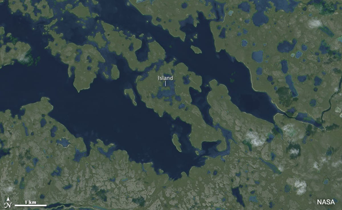
A nameless island within Victoria Island in Canada’s Nunavut Territory holds the rare distinction of being the world’s largest island-in-a-lake-on-an-island-in-a-lake-on-an-island.
Satellite images by the Operational Land Imager (OLI) on Landsat 8 confirmed the presence of this unique landform. Here’s how it goes: at the centre lies a seahorse-shaped island, approximately 1,000 feet wide, situated within a small, unnamed lake. This lake itself is part of a larger island, which sits inside a long, finger-shaped lake about 90 kilometres inland from Victoria Island’s southern coast.
Guinness World Records has officially recognised this location as the largest of its kind. Given that Victoria Island – also known as “Kitlineq” by the Inuit – is the eighth-largest island in the world and part of the vast Canadian Arctic Archipelago, there is potential for undiscovered landforms of a similar nature. The region, dotted with thousands of islands and millions of post-Ice Age lakes, remains largely unexplored.
Many recursive islands and lakes, meaning landforms that follow a pattern of islands within islands or lakes within lakes, have been identified using satellite imagery. However, due to the extreme remoteness of this Arctic landscape, it is highly likely that no human has ever set foot on this particular island. As mapping technologies and satellite images continue to improve, the discovery of more unusual landforms may still be ahead.
Earlier, NASA satellites observed a temporary island emerging off the coast of Azerbaijan in the Caspian Sea, only for it to disappear within two years. The landmass, created by an eruption from the Kumani Bank mud volcano, was first spotted in early 2023 and had eroded completely by the end of 2024. The eruption, which lasted just a few days in February 2023, was one of many recorded in the area, with similar events dating back to 1861.